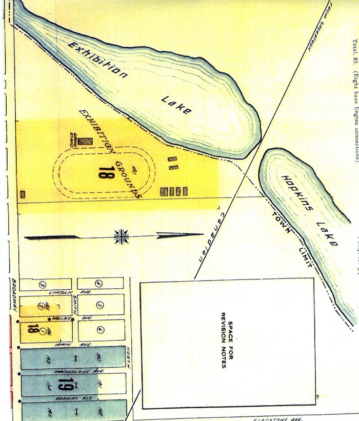
While the new Yorkton town site was being built in July of 1890, the colonists held a picnic on Section 3 Township 26 Range 4 West of the 2nd Meridian. There were 200 people in attendance. They played cricket and baseball, boating on the pretty little lake, archery, swings and sports for the boys including a tug-of-war between the two schools Yorkton vs Orkney, resulting in a Yorkton victory. (From the MANITOBA DAILY FREE PRESS July 28, 1890.) The lake they refer to is HOPKINS LAKE. The map of the area shown here is dated 1923, and shows Hopkins Lake outside the town limits.
More recent history is told by local resident Ray Riesz: I remember Hopkin’s Lake and connecting wetlands extending from the CNR tracks south almost to the CPR tracks. In the early ‘60’s the Jaycee Club wanted to make the area a picnic and swimming spot. Through fundraising and support from city council they dredged the lake bottom, (similar to the work done at Wascana Lake) and hauled in loads of sand for the swimming area and beach. The material that was removed was used to create a bank on the west side and a dike on the north side (where #16 Hwy is now). I think some of the removed material was also hauled to the north side of the CNR tracks to fill in some of the wetlands there. On the west side of the lake was a natural spring which flowed slowly all winter. Here a well was developed and fresh water was pumped to the lake when needed. The irregular line shown on the map north of the tracks I believe was part of the lake prior to the tracks being built. There was a dugout there close to the CN right of way that was used as a swimming hole in the 40’s.


